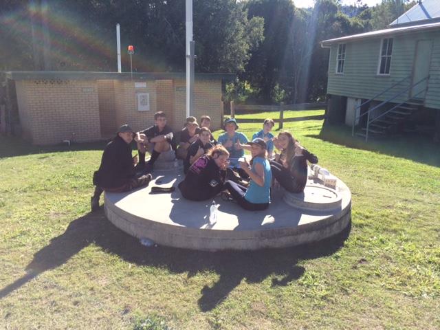
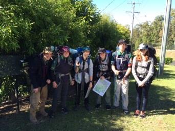
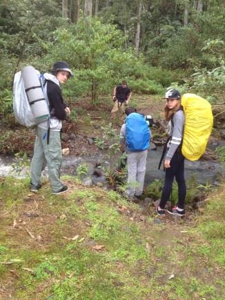
My hike began on the 25th of June 2016. My patrol assembled at the Greenbank den and then drove to our starting point on Orange Ct Mudgeeraba were we began our journey into hell, or the thirty kilometre three-day hike equivalent, whichever your point of view.
 Day 1:
Our first day was fairly easy navigation-wise as we sticked to a bush track that was obvious for the most part until we reached the hill at about 10:30. Now the reason my patrol and I will always refer to this particular hill as the hill was because not an hour into our hike we were stuck at an intersection, which in hindsight I probably should have thought about for a bit longer. Before my hike started Barramundi & I had worked out that at an intersection early in my hike I would have the choice of going up a massive hill or follow a path that went along a ridgeline to the left of it. When I got to this intersection, as I said before, we faced the hill and instead of following the ridgeline, which at that point in time I had no bearings for and looked like it would head in the complete opposite direction, we went up the hill (What. An. Idiot.).
 After that charming experience we followed a fence line at the top of the peak to get to Knack Rd. We then hiked along knack road to get to our first water drop, checkpoint 1, and whilst doing so passed a house, which was home to a very eager border collie named Genius. Genius then felt it his responsibility to guide us to our water drop and beg for more belly scratches. After breaking at our water drop, we all agreed to try and get him back home so he didn’t follow us and get lost.
The rest of the day was very much up and down small peaks until we finally entered our first camp, Mt Nimmel Lodge, at around 3:00 in the afternoon. Barramundi and Mang then left the campsite at around 4:00 to go and give Jordenn and his patrol water. They then got back to the lodge at 6:00. We all got into our freezing cold beds at around 8:00 that night.
Day 2:
The second day of my hike started at many different times for many different people. For Reece and I, wake up was at about five o’clock. We then woke up the rest of the patrol at sunrise (about 6:00) and were gone by about a quarter to eight. The track for day two started on Tallowwood Road which then turned onto Austinville Road and then became a no-through dirt road. After exiting the no-through road we passed a few old farm-like residences on our way to Mt Nimmel road. The track that we followed off the no-through road branched off on intersections that didn’t show up on my main map. Barra had already planned for this to happen and had printed out a map that showed all of these smaller tracks and we made it to the road.
It had been Barra and Mang’s goal for the whole hike, to keep us off the main roads as much as possible. They both conceded that it was necessary to follow these roads for a short period of time. When we finally arrived at checkpoint three and moved on to the park opposite Polly’s Kitchen, we stopped for a short break to refill our water, to eat and to prepare for what awaited us on the next section of our journey.
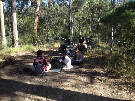
After our water break, we had to trek up a massive hill to reach the peak at checkpoint four. I honestly could write war and peace on the pain that we endured on our hike up that spur but to keep it short and sweet, it was very long and very painful. We reached the peak at about 12:30 and stopped for lunch and some photos.
 To continue on our track, we had to double back along a fire trail which intersected with the walking track we had just come up. As we began a large incline towards one of the peaks along the trail (I think it was waypoint 4.2) we crossed paths with Jordenn’s patrol and stopped for a couple of minutes to chat and exchange notes on the track ahead. Jordenn advised us that towards the end of the fire trail we were currently on, that there would be an intersection that didn’t show up on the map and that we were to continue left and stay left.
 We then went our separate ways and began the next hilly section of our journey. About halfway along the fire trail we were all feeling pretty dead and then Jett just stopped, keeled over and started to dry-heave in the bush. It was no secret that Jett had been taking the hike pretty hard and always needed to rest, the whole patrol accepted that. I had thought that he was just tired and sore like the rest of us but when he keeled over I knew I had pushed him too hard. I made a call to Barra and it was decided to share his pack’s weight amongst the rest of us until we got to the water drop.
Jett was feeling much better by the time we got to our water drop at checkpoint five and put all of his stuff back into his pack again. We had only made on small error by that point, we had turned left too many times. There was another intersection after the one Jordenn had talked about and we turned left instead of going straight like we were supposed to. After turning left the second time, we ended up in someone’s back yard rather than the previously arranged paddock. We had no idea about what we had done and upon encountering the owner were told that we shouldn’t have come this way. She still let us past (grudgingly) and we made it to our water drop.
 At the water drop on Pine Creek Rd we followed the right hand road at
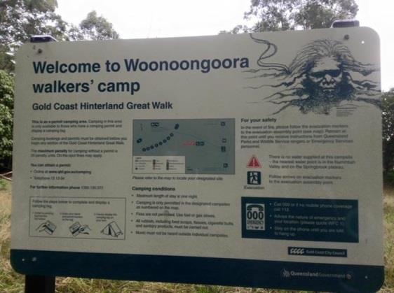
an upcoming fork. This road than led past Wunburra Lookout (which was in the left hand side) and straight to Apple Tree Park where the leaders gave us a welfare check before going down the stairs to Woonoongoora Walkers Camp. If you look at the photo, we took of the sign at the top of the stairs you will understand why we needed that welfare check. But we all made it to the bottom and set up camp (camp was literally 30 metres to the left of the stairs) at about five o’clock that night. I learnt a lot that night; one – that wallabies sound exactly like wild dogs when you can’t see them in the dark, two – that my patrol was full of Nutella addicts and three – that you can do a lot with a single bush lemon when you are with a group of teenagers. All jokes aside it was a much easier, more laid back and blissfully warmer night.
 Day 3:
Our last day and always been planned to be the shortest and easiest. Unfortunately for us, it went a little bit pear shaped…. We started hiking on our third day at 9:00 due to an amazing sleep-in. As per our map, we followed a great walks trail passed some creeks, through some paddocks and all the way to an intersection that lead off in three different directions that we (as amazing little scouts would) took the wrong turn on. Now, I wouldn’t judge to harshly as the fault is mine because my faulty bearings did not in fact point in the right direction. After a couple of hundred metres it started to dawn on me that I wasn’t completely sure I knew where we were. I decided that we would keep following the great walk to the main road, which we could hear faintly in the distance. We continued in the same direction and passed all intersections until we finally got to our last intersection, the choice being; go right on the great walk track, go straight into someone’s private property or go left and follow an exit sign that I took as our salvation. We decided to follow the exit sign for a while and ended up really close the road (we could literally see it), now all that stood between us and that road was about five paddocks worth of private property.
 We then considered our options and the decision came down to me; go back and figure out a way onto the road using the tracks or hightail it through the paddock like ninjas and hope we don’t get shot by land owners (I wonder which one he picked?). I honestly had no interest of going back a couple of K’s to figure out another track so (as you probably guessed) we decided to play ninja and cross the paddocks. Long story short, we weren’t ninjas, we managed to escape the eyes of a tractor driving farmer (either that or he couldn’t be bothered chasing us) but after that it was just us sprinting across open paddocks with brightly coloured hiking packs.
When we reached the last gate, no joke, someone stopped at the bottom of their driveway to talk to us. But as he got out of his car (I was literally ready to resort to grovelling to let us pass) we saw that he wasn’t some rage old ball of red neck fury, he was in fact an extremely nice middle aged man who actually laughed with (not at) us, at our misfortune. The man even went as far as to tell us where we went wrong and as he said “You cut a whopping great corner to get here, that’s all.” We all laughed and when I asked him where our finish was, The Numinbah Valley Café or ‘Fudge Heaven’, we were all struck dumb as he turned and pointed. Not a hundred metres ahead was the blue ‘Fudge Heaven’ sign and smiling that smile of his he said goodbye to us and drove-off. We couldn’t believe our luck, not only did we take a short-cut but we didn’t get shot and we ended up really close to our finishing location.
My hike had always been planned to finish a couple of hours before Jordenn’s and because of our detour we had about half an hour extra. After waiting at the café for those couple of hours the leaders finally picked us up with the other patrol in tow and we all had lunch and said our goodbyes. My hike finished successfully on Monday the 27th of June at 11:30am.